Anniversary Trail West
East Camberwell to Dennis, Distance: 11km
Region: Eastern Melbourne
Written up by: U3A Yarra City OYB
Last ridden: 7 September 2018
Cafes | Terrain | Ride Details | Variations | Maps
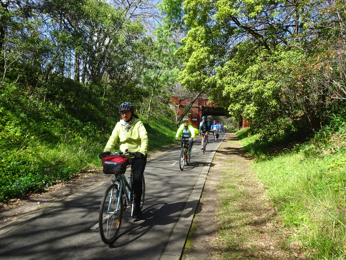
On Anniversary Trail.
Overview
This ride follows the route of the long-defunct Outer Circle railway line through parkland in Melbourne’s leafy eastern suburbs, before dropping down to continue through bushland along the Yarra River and a short stretch of mostly very quiet suburban streets to the famous Fairfield Boathouse café on the banks of the river. It continues through parkland and quiet suburban streets to finish at Clifton Hill railway station.
Along the old Outer Circle railway line there are detailed history boards to read. The original railway line was built in the late 1880s when there was a land boom in Melbourne. It was opened in 1890 and operated in its entirety for only three years closing between 1893 and 1895 as a result of the depression. The section from East Camberwell to East Kew was reopened between 1900 and 1943. The passenger service on this section was known as the “Deepdene Dasher”.
Look for views of the city as you ride through Kew.
Cafes and Toilets
There are coffee shops at Harp Junction and one on Heidelberg Road, but it is probably worth saving your thirst for coffee until you reach the famous Fairfield Boathouse on the well-wooded banks of the Yarra River.
There are no toilets at Camberwell station. There are no reliably open toilets between East Camberwell station and Fairfield Boathouse. There are toilets at the Boathouse, in Fairfield Park and at Clifton Hill station.
Terrain
Except for about 600 metres along Heidelberg Road, the ride is on sealed off-road bike paths and quiet suburban streets. It is advisable to start this ride from East Camberwell station, as the route from the station to the Yarra River is virtually all very gently downhill. The only uphill sections, both brief, are from the Yarra River to Heidelberg Road, and from Fairfield Boathouse to Fairfield Park.
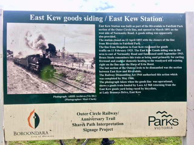
The Outer Circle Railway
Warning: At the time of writing (September 2018) the rebuilding of the Chandler Highway Bridge over the Yarra and the realignment of Chandler Highway were underway. When these works are completed the bike paths in the area may be slightly different from what is described here.
Ride Details
East Camberwell Station to Harp Junction (3.7km)
Start on the north side of East Camberwell Station.
Head east for about 100 metres, ignoring the pedestrian subway.
Turn left onto a marked shared path. Continue about 100 metres to the Anniversary Trail and turn left onto the trail running through Boroondara Park.
Pass under Canterbury Road and Mont Albert Road.
Cross Barnsbury Road. Be aware that the trail continues from a point across the road about 25 metres to your left.
Cross Whitehorse Road at a pedestrian light and continue to Burke Road.
Cross Burke Road and follow the trail through unnamed parkland to High Street at Harp Junction in Kew.
Harp Junction to Main Yarra Trail (2.0km)Cross High Street at the traffic lights. The trail continues from a point on High Street about 25 metres to your left.
Walk your bike down to this point and turn right onto the continuation of the trail.
A parking area lies to your right, between the trail and Valerie Street.
Do a half-circle around the north side of the large roundabout at the western (lower) end of Valerie Street and continue downhill along the trail. This section of the trail is separated from Asquith Street (to your left) by a belt of trees growing on the old Outer Circle railway line embankment.
At the bottom of the hill DO NOT continue straight ahead to Chandler Highway. Instead, turn sharp right onto an unnamed path.
Follow this path as it winds gently downhill through parkland, crossing Sutherland Avenue and Connor Street, to reach Kilby Road.
Cross Kilby Road and go through the cavernous tunnel under the Eastern Freeway, to the Main Yarra Trail at the northern end of the tunnel.
Main Yarra Trail to Fairfield Boathouse (3.9km)Turn left onto the Main Yarra Trail, which runs beside the Yarra River to Chandler Highway.
When you see the Chandler Highway bridge looming ahead of and above you, turn left uphill to exit to the Highway.
Cross the Highway at the pedestrian light and turn right to cross the Yarra using the Chandler Highway Bridge.
Once across the river, take the first turn left into (the very short) Rex Avenue, then turn right to follow Coate Avenue gently uphill to Heidelberg Road.
Turn left onto Heidelberg Road and follow it several hundred metres to Alphington Street.
Turn left into Alphington Street and follow it to a roundabout, where you turn right into Park Crescent.
Follow Park Crescent to its end at Fairfield Park.
Bear left down any one of the steep paths to Fairfield Boathouse.
Fairfield Boathouse to Dennis Station, Northcote (1.0km)From the Boathouse, come up the short steep road to the bushy roundabout at the top.
Ride around the north side of the football / cricket pitch in Fairfield Park. (Path not recognised on Google Maps.)
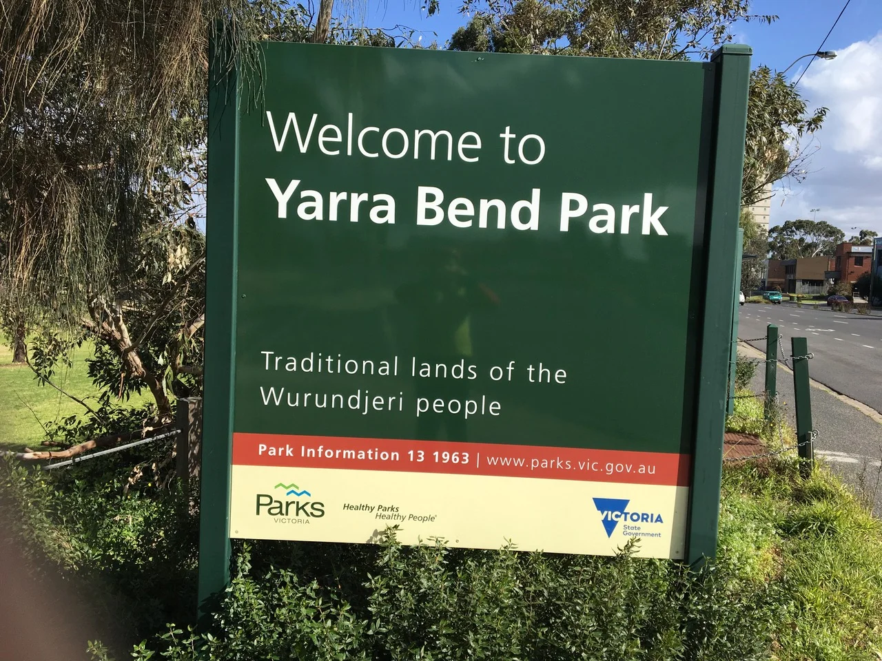
Cross Yarra Bend Road and drop down into Yarra Bend Park. Follow the shared path to the right to Heidelberg Road.
Turn left onto Heidelberg Road and go over the bridge across Merri Creek.
Once across the bridge, turn left into The Esplanade, then right into Spensley Street.
Follow Spensley Street through several roundabouts to Clifton Hill station.
Variations
Shorten the ride
by finishing at Fairfield Station. When riding along Heidelberg Road turn right at step 19 and carefully cross Heidelberg Road to head north along Broomfield Street. Turn left into Railway Place which will take you to Fairfield Station.
Extend the ride
by doing Anniversary Trail South in reverse first
or
by adding Yarra Trail 3. The two rides meet at Yarra Bend Road.
Maps
Melway or Melway Online: Starts at map reference 46 A11
Google:
Please click on box with arrow at top left corner to see the map legend.
Please click on box at top right corner to see the map in Google Maps. You must be logged into Google Maps to do this.
