Capital City Trail West
Rushall to Southern Cross Station, Distance: 11 km
Region: Western Melbourne
Written up by: U3A Yarra City OYB
Last ridden: 5 February 2021
Cafes | Terrain | Ride Details | Variations | Maps

The Moonee Ponds Creek under Citylink.
Overview
On this route, you will enjoy riding along the parklands across the north of Carlton, the Moonee Ponds Creek and the mighty Yarra.
The route is along the Capital City Trail, starting at Rushall Station going west across the north of Carlton, underneath Royal Parade and on past sports ovals towards the zoo.
At Royal Park Station it heads south along the railway line before combining with the Moonee Ponds Creek trail. Here it is fascinating to contrast the calm serenity of the Moonee Ponds Creek with the massive structure that is the Tullamarine Freeway.
Turning east and south east, the ride goes through Docklands. Once an industrial wharf, this is now a bustling residential area with a football stadium and a marina full of private yachts. Look for “Cow up a tree”, a sculpture on the waterfront, just behind a pop up café.
Eventually the ride crosses the Webb Pedestrian Bridge, the design of which is based on the idea of sculptor Robert Owen who imagined the bridge as a Koori eel trap. After crossing the bridge, the trail turns left along the Yarra past the Polly Woodside, a tall ship, to finish at Melbourne Exhibition Centre (Jeff’s Shed), just south of Southern Cross Station.
Cafes
There are cafes and toilets in Docklands and along the Yarra, and toilets inside Jeff’s Shed.
Terrain
The ride is along bike paths. It is mainly downhill or flat.

Riding toward the Webb Bridge.
Ride Details
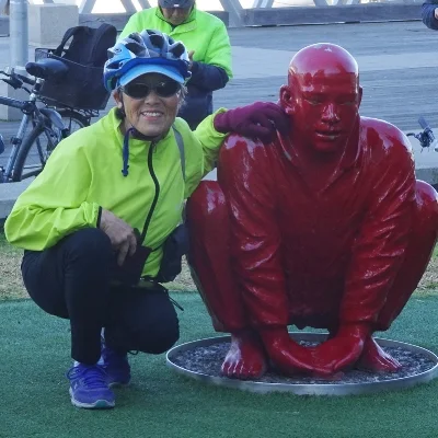
Meeting 1: Sculpture at Docklands by Wang Shugang
Rushall Station to Royal Park Station (3.6km)
The ride starts on the south side of Rushall Station.
Head west along the Capital City Trail crossing several roads to Princes Park.
You then ride through an underpass under Royal Parade and emerge with sports ovals on your left and the railway cutting to your right.
Continue until you come to Royal Park Station on your right.
Royal Park Station to Footscray Road (4.4km)Here the trail crosses the railway line, Poplar Road and the tramline.
Immediately after the tramline turn left and continue along the trail, with the tram line and railway line on your left hand.
At Flemington Bridge Station the trail follows the ramp down to street level and then turns left onto the Moonee Ponds Creek Trail to follow the Moonee Ponds Creek downstream.
Follow the trail, with the Moonee Ponds Creek to your right, passing under Arden Road and Dynon Road, until you reach Footscray Road.
Footscray Road to Southern Cross Station (3.1km)Cross Footscray Road and turn left (or east) towards the city, onto the trail which is now along a shared footpath bordering Footscray Road.
Follow the trail alongside Footscray Road and Harbour Esplanade until you reach Navigation Drive (just after Collins Street).
Turn right and then left to use the Webb Bridge to cross the Yarra.
Once across the river, turn left and follow the Yarra River back to the Melbourne Exhibition Centre (Jeff’s Shed). Southern Cross Station is across the river and one block north, on Spencer Street.
Variations
Alternative Scenic Route in Docklands (dark pink on map below)
At step 9 above, cross Footscray Road and Pearl River Road to find the Moonee Ponds Creek Trail, which is the shared path on the right of Pearl River Road (when facing south).
Ride south for 800m to reach the end of the Moonee Ponds Creek Trail where you should see tramlines to your left on Docklands Drive.
Turn left and ride 100m to reach Docklands Drive.
Ride along Docklands Drive for 100m and turn right onto Wattle Road.
Go down Wattle Road to the end and turn left here and ride 600m along the riverside to Harbour Esplanade.
Turn right to resume the ride in Step 10.
Extend this ride by one of the following:
Turn right just after the Webb Bridge and doing Westgate Park.
Combine with Capital City Trail East. Continue along the Yarra River from Melbourne Exhibition Centre and go under Princess Bridge. Then follow the directions back to Rushall.
Combine with Bay Explorer. Follow the directions from Melbourne Exhibition Centre.
Maps
Melway or Melway Online: Starts at map reference 30 D11
Google:
Please click on box with arrow at top left corner to see the map legend.
Please click on box at top right corner to see the map in Google Maps. You must be logged into Google Maps to do this.
Note that at the purple star, Google does not recognise the bike trail. Be assured that it continues alongside the road. Keep Harbour Esplanade to your left.
